The Changing Coasts of Fort Point Channel:
A History of Development and Industry in Fort Point
A History of Development and Industry in Fort Point
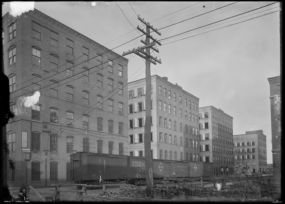
Looking down the Binford Street railroad spur in Fort Point, circa 1900.
Today’s Fort Point neighborhood is an eclectic mix of residential, commercial and cultural development. Distinctive art galleries, startup companies and small businesses call the neighborhood home, reflective of the creative spirit of the South Boston Waterfront’s larger Innovation District. But while Fort Point’s “Innovation District” title is recent, the neighborhood has been home to an innovative spirit since its original landmaking. Fort Point’s characteristic large, loft-style brick buildings tell the story of a significant industrial and manufacturing presence that once dominated the area.
On my 90-minute walking tour, we’ll discuss how the function and infrastructure of the Fort Point neighborhood have changed over time, from a predominantly industrial neighborhood to a mixed-use fabric. As we walk along Fort Point’s historic streets, bridges and narrow alleyways, we’ll note remnants of Fort Point’s various phases of functionality and development and learn how trends in transportation and trade influenced Fort Point’s evolution. Aided by historic maps and photographs, we’ll look back at past uses of key Fort Point sites and at the various influential organizations that have called Fort Point home. Along the way, we’ll note the various completed, under construction and planned real estate development projects that are sustaining Fort Point’s latest wave of development and innovation.
Stops include:
We will meet at Iron Street Park in Fort Point on Sunday, July 12th, 2015 at 10:30 AM. The tour will last 90 minutes and will end by South Station in Dewey Square.
Note: Iron Street Park is located on Iron Street, between A Street and Channel Center Street. The nearest MBTA station is Broadway Station on the Red Line.
Price: $20.00. Buy tickets below or on the Eventbrite page, https://eventbrite.com/event/17558898137/.
On my 90-minute walking tour, we’ll discuss how the function and infrastructure of the Fort Point neighborhood have changed over time, from a predominantly industrial neighborhood to a mixed-use fabric. As we walk along Fort Point’s historic streets, bridges and narrow alleyways, we’ll note remnants of Fort Point’s various phases of functionality and development and learn how trends in transportation and trade influenced Fort Point’s evolution. Aided by historic maps and photographs, we’ll look back at past uses of key Fort Point sites and at the various influential organizations that have called Fort Point home. Along the way, we’ll note the various completed, under construction and planned real estate development projects that are sustaining Fort Point’s latest wave of development and innovation.
Stops include:
- Channel Center
- Melcher Street
- Fan Pier
- Atlantic Wharf
We will meet at Iron Street Park in Fort Point on Sunday, July 12th, 2015 at 10:30 AM. The tour will last 90 minutes and will end by South Station in Dewey Square.
Note: Iron Street Park is located on Iron Street, between A Street and Channel Center Street. The nearest MBTA station is Broadway Station on the Red Line.
Price: $20.00. Buy tickets below or on the Eventbrite page, https://eventbrite.com/event/17558898137/.
