Any questions? Feel free to shoot an email:
Boston Streetcars
  • Home
  • Media
    • About Streetcar Tracks
    • Script
    • Press
    • About The Author
    • Research Process
  • About the T
    • Mattapan High-Speed Line
    • Green Line >
      • Subway
      • B Branch
      • C Branch
      • D Branch
      • E Branch >
        • What Happened to the Arborway Line?
      • What Happened to the A Line?
    • Trackless Trolleys
    • Orange Line
    • Red Line
    • Blue Line
    • Photographing the T
  • Articles
    • Why Are There Still Streetcars in Boston?
    • Boston's Cancelled Highways
    • The West End's Transformation
    • How A Streetcar Works
    • "Streetcar Suburbs" of Boston >
      • Triple Deckers of Boston
      • Dorchester's Blue Hill Avenue
      • Dorchester's Jones Hill: How the Hill Developed
    • Trolley Remnants
    • Transit Hubs of Boston >
      • Sullivan Square
      • Dudley Square
      • Massachusetts Station
      • Egleston Square
      • Copley Square
      • Grand Junction Railroad
    • Trolley Types of Boston
    • The Growth of Boston Rapid Transit
    • Five Key Future Boston Transit Investments
    • Streamlining Boston Transit to Olympic Specifications >
      • Comments on South Boston Transit Study
    • Last Time Over the Casey Overpass
  • Tours
    • About
    • FAQ
    • Descriptions of Tours >
      • Changes in Boston's West End
      • The Evolution of Commonwealth Avenue
      • Changes Around Copley Square and Northeastern University
      • Urban Development Along the Freedom Trail
      • "Streetcar Suburbs" of Boston: Dorchester's Ashmont
      • Along the Greenway
      • Development of Dudley
      • Working Waterfront
      • Fort Point
    • Reviews
Last Time Over the Casey Overpass
My video of my last time passing over the Casey Overpass in Jamaica Plain:
Video was taken on May 11th, 2015—five days before the Overpass was closed to car traffic (on May 16th, 2015) and subsequently demolished. The Casey Overpass was an elevated route for the Arborway through Boston's Jamaica Plain neighborhood, right by the Forest Hills MBTA station. The Overpass was constructed in 1955 and was built especially tall in order to pass over the Washington Street Elevated, an elevated structure that once carried the MBTA Orange Line rapid transit. Orange Line service was moved from the El to the new, lower Southwest Corridor right-of-way in 1987, and the El was subsequently demolished. The Southwest Corridor ran below the Overpass in a tunnel.
Picture
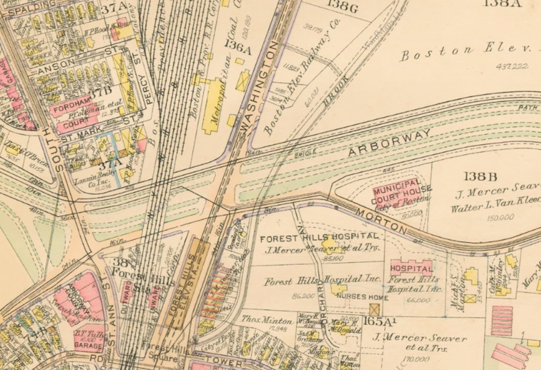
The original street-level Arborway in 1924. The Casey Overpass would pass over three rail lines:
  1. The New York, New Haven and Hartford RR's right-of-way
  2. The Washington Street Elevated (later Orange Line)
  3. The Route 39/Arborway-Downtown streetcar. (Route 39 later became the E Branch of the Green Line. The E Branch was later cut back to Heath Street.)
Picture
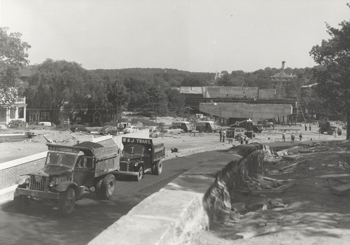
Casey Overpass under construction in the early 1950s.
Picture
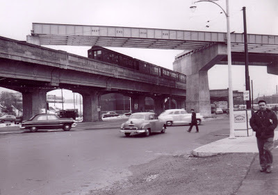
View of the under-construction Casey Overpass passing over the Washington Street Elevated.
Powered by Create your own unique website with customizable templates.