Boston—Where We Walk on Water Daily
If you've walked through Boston today, chances are that at some point you walked over one of Boston's formerly prominent bodies of water. You may even be sitting on a body of water right now. Reading this in a coffee shop in the South End or Fort Point? Both neighborhoods, as well as a number of others, are built upon former bodies of water filled in over the course of the 19th century.
The 1775 map above shows Boston and its surroundings in the area's original form. Boston's original downtown consisted of the Shawmut Peninsula, shown in maroon above—a small mass of land connected to the Roxbury, Dorchester and the mainland by a narrow neck along which ran what is now Washington Street in the South End. The Back Bay, the South End, the Bulfinch Triangle/West End and the entire Seaport District/Fort Point are nowhere to be found at this time. Much of today's Southie is nonexistent as well—Castle Island is an island, disconnected from the mainland. A number of rivers and streams run through the mainland, the most prominent of which are the Charles River, the Muddy River and the Stony Brook. EASTIE (CHARLESTOWN)
As Boston continued to grow, the surrounding water bodies were filled in. The bay directly west of downtown was filled beginning ADD TO ADD and became the Back Bay and the South End west of Washington Street. ADD SOUTH BOSTON/SOUTHIE/SOUTH BAY. ALSO WEST END AND MILL CREEK.
Further south in Roxbury and Jamaica Plain, many mills and factories set up shop along the banks of the Stony Brook to take advantage of the flowing water POWER. In particular, the Stony Brook attracted a number of breweries--HOW MANY! Beginning in WHEN, the Stony Brook was redirected into an underground culvert extending from the Muddy River and the Bay Bay Fens SOUTH:
The Stony Brook Conduit extending from the Fens to Parker and Forsyth Streets by Northeastern University.
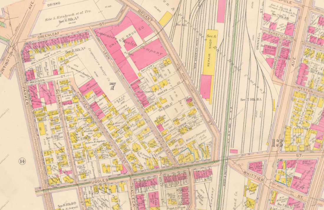
Another view of the Stony Brook Culvert in Roxbury—one branch under Parker Street, and another extending through the present-day Northeastern campus, under the Southwest Corridor and further along Whittier Street by the present-day public housing project.
Both culvert branches come together by Roxbury Crossing. Note the large industrial presence along the culverts in this 1915 map.
AP BLAKE MAP https://www.google.com/maps/d/viewer?t=h&ie=UTF8&msa=0&z=12&hl=en&mid=zkzJ76knxAcM.kmUTV3DOt1IU ASK FOR PERMISSION
Millions of people walk above Boston's concealed waterways and bays daily, yet as of now there is no public display honoring DEVELOPMENT.
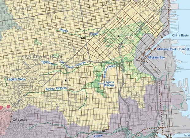
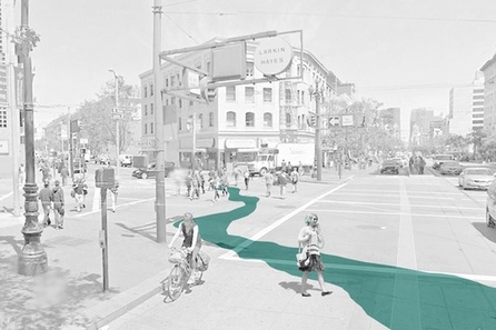
San Francisco, a city with a related history of fill in bays and creeks to expand its limits, is planning a WORD display that will make the city's development HISTORY clear and easily accessible FOR ALL:
http://www.citylab.com/design/2014/11/san-francisco-is-painting-the-streets-with-historical-creeks/382655/
SF ALSO LANDFILL
LET'S HONOR OUR HISTORY WITH PUBLIC ART
LET'S HONOR OUR HISTORY WITH PUBLIC ART
art would outline our history and highlight how far we've come as a city(—empowering future generations to continue growth.)


